The Ultimate Guide to Leveraging Drone Data for AEC Projects in 2025
The Ultimate Guide to Leveraging Drone Data for AEC Projects in 2025
The construction, engineering, and architecture industries have always relied on technology to push boundaries and solve complex problems. Today, drones are making a big impact by providing powerful tools for data collection, visualization, and analysis. In 2025, using drone data in Architecture, Engineering, and Construction (AEC) is no longer just an advantage; it's becoming an industry standard. By understanding how to integrate drones effectively, firms can improve project accuracy, save time, and reduce costs.
In this guide, we’ll explore how drone technology is transforming AEC projects, highlight best practices, and look ahead at emerging trends shaping the future of this innovative field.
The Evolution of Drone Technology in AEC
Drones have evolved from simple aerial photography tools to sophisticated data collection platforms. Equipped with advanced sensors and cameras, they capture high-resolution images, generate 3D models, and provide real-time data. This evolution has transformed project planning, monitoring, and execution in the AEC sector.
Key Applications of Drone Data in AEC Projects
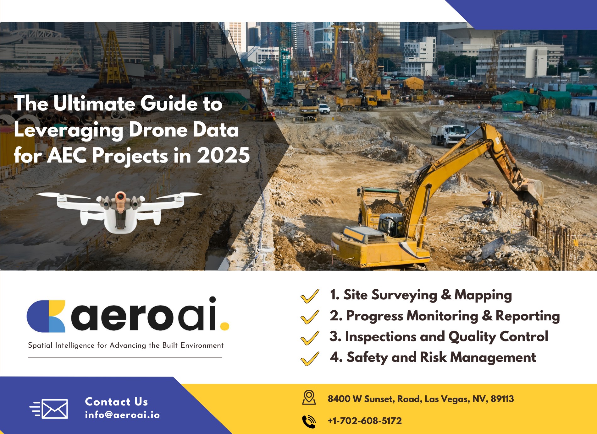
1. Site Surveying and Mapping Traditional surveying methods are often time-consuming and labor-intensive. Drones expedite this process by capturing comprehensive site data swiftly. The aerial imagery collected can be processed into detailed topographic maps and 3D models, offering a clear overview of the terrain and existing structures. This capability is particularly beneficial for large or complex sites where ground access is challenging.
2. Progress Monitoring and Reporting Regular monitoring of construction progress is crucial for project management. Drones provide up-to-date visual records, enabling stakeholders to assess progress against schedules and identify potential delays. This real-time insight facilitates proactive adjustments, ensuring projects remain on track.
3. Inspection and Quality Control Drones equipped with high-resolution cameras and sensors can perform detailed inspections of structures, identifying defects or deviations from design specifications. This approach enhances safety by reducing the need for personnel to access hazardous areas and ensures quality standards are maintained throughout the construction process.
4. Safety and Risk Management By providing comprehensive site overviews, drones help identify potential safety hazards, such as unstable structures or unauthorized site access. This information is vital for implementing effective safety protocols and mitigating risks, thereby protecting workers and assets.
Advancements in Drone Technology Impacting AEC
The evolution of drone technology continues to introduce new capabilities that benefit the AEC sector: Integration with Building Information Modeling (BIM): Drones can capture data that integrates seamlessly with BIM platforms, enhancing the accuracy of models and facilitating better collaboration among project teams. Thermal Imaging: Equipped with thermal cameras, drones can detect heat loss in buildings, identify electrical issues, and assess the integrity of materials, contributing to more efficient maintenance and energy management. Artificial Intelligence (AI) and Machine Learning (ML): Advanced drones utilize AI and ML to analyze collected data, identifying patterns and anomalies that may indicate structural issues or areas for improvement.
Implementing Drone Technology: Best Practices for AEC Success
Leveraging drone data in Architecture, Engineering, and Construction (AEC) projects requires a thoughtful and strategic approach. Implementing drones effectively goes beyond buying equipment and hiring operators. It demands careful planning, proper training, and integration into broader project workflows. Here's how to ensure success:
1. Are Drones the Right Tool for Your Project?
Before investing in drones, it’s critical to assess whether they’re the right solution for your needs. For projects involving large-scale site surveys, hazardous inspections, or frequent progress monitoring, drones excel. However, for smaller projects or highly detailed indoor work, alternative technologies like terrestrial laser scanning or fixed-camera setups might be more appropriate.
Conduct a needs assessment with input from your team to determine if drones align with project goals and budget constraints.
2. Choosing the Right Drone and Equipment
The choice of drone and payload depends on your specific project requirements: Fixed-Wing Drones are ideal for large-scale surveys and mapping because of their longer flight times and range. Multi-Rotor Drones offer superior maneuverability, making them perfect for inspections or detailed data collection in confined areas. Payload Selection Cameras, thermal imaging sensors, LiDAR scanners, or multispectral sensors can provide the precise data you need. Ensure compatibility with your drone and software ecosystem. Work with industry experts or vendors to select a drone solution that meets your technical requirements and budget.
3. Building a Drone Program, Not Just Hiring a Drone Operator
Many organizations make the mistake of relying on a single “drone person” without a scalable program. To truly integrate drones into your operations, establish a structured drone program that includes: Standardized Procedures Develop detailed workflows for planning flights, capturing data, and processing results. Cross-Training Train multiple team members to operate drones, reducing the risk of disruptions when a key operator is unavailable. Dedicated Roles Assign roles like drone program manager and data analyst to oversee operations and ensure insights are actionable. Scalability Plan for expanding your fleet or capabilities as your projects evolve.
4. Comprehensive Training and Certification
Proper training is fundamental. All operators should: Hold Relevant Certifications Comply with local and international aviation regulations by earning certifications like the FAA Part 107 Remote Pilot Certificate in the U.S. Master Data Collection Learn the technical aspects of capturing high-quality data, including flight planning, sensor calibration, and troubleshooting. Understand Use Cases Training should extend beyond drone operation to industry-specific applications, like using LiDAR for volumetric analysis or thermal imaging for energy audits. Collaborate with training providers or professional associations to ensure staff are fully equipped for AEC applications.
5. Regulatory Compliance and Risk Management
Drones are subject to strict regulations regarding their operation. To avoid delays or penalties: Secure Permits Obtain all necessary permissions from aviation authorities for your flight locations. Mitigate Risks Conduct pre-flight risk assessments, such as ensuring safe airspace and confirming weather conditions. Insurance Coverage Maintain adequate insurance to protect against liabilities related to drone operations.
6. Integration with Existing Systems
The real power of drone data lies in its ability to enhance existing workflows. To achieve this: Connect with BIM Platforms Import drone data into Building Information Modeling (BIM) software for seamless collaboration and visualization. Centralized Data Management Use cloud-based platforms to store, analyze, and share data across teams. This ensures accessibility and prevents data silos. Automated Workflows Leverage software to automate repetitive tasks like flight planning and report generation.
7. Data Management and Security
Drones generate large volumes of sensitive data that must be securely managed. Implement robust systems to: Organize and Analyze Data Use geospatial software to process raw drone data into actionable insights. Back Up Regularly Maintain secure backups to prevent data loss during system failures. Ensure Cybersecurity Protect sensitive project data from breaches by employing encryption, secure access controls, and regular audits. By investing in proper tools, training, and systems, organizations can create a sustainable drone program that maximizes the technology's potential. These best practices ensure that drones aren’t just a flashy addition but an integrated part of your AEC workflows, delivering consistent value across projects.
Future Trends: The Road Ahead
As we approach 2025, several trends are poised to shape the use of drone data in AEC: Increased Automation Advancements in AI will lead to more autonomous drone operations, reducing the need for manual intervention and increasing efficiency. Enhanced Data Analytics Improved analytical tools will enable deeper insights from drone data, facilitating predictive maintenance and more informed decision-making. Expanded Use Cases Beyond construction, drones will play a larger role in facility management, environmental monitoring, and urban planning, offering comprehensive solutions across the project lifecycle.
Conclusion
The integration of drone data into AEC projects represents a significant advancement in how we design, construct, and manage built environments. By embracing this technology, firms can achieve greater accuracy, efficiency, and safety in their operations. As drone technology continues to evolve, staying informed about the latest developments and best practices will be essential for maintaining a competitive edge in the industry.