The way someone enters a project matters. A specialist may need time to explore an immersive scene. A colleague may need a browser link and a clear explanation of one issue. Both need to understand the same place, but they do not necessarily need the same interface.
SiEGA’s development reflects those different needs. Desktop and Web provide distinct ways to work with spatial information, connected by the goal of making a project easier to understand.
A desktop foundation
The release history dates SiEGA’s initial desktop release to June 17, 2025 and the 2.2 update to March 6, 2026. Desktop offers an immersive way to explore project context and simulation.
That kind of experience is valuable when the relationship between a person, a structure and its surroundings is central to the discussion. Navigating at ground level can prompt different questions from looking down at a map.
Another entry point in the browser
SiEGA Web makes the project accessible through a browser. It offers a place to explore data and share context without making a desktop installation the first step in a discussion.
Start with a view that explains the question, supply enough background to interpret it and invite the next person to explore. The value is in reducing the distance between preparing information and discussing it.
The same project can involve different kinds of attention
During preparation, a specialist may spend time checking placement, organizing layers and choosing views. During review, a project manager may have only a few minutes to understand a particular issue. During presentation, the goal may be to explain a sequence of ideas to people who are unfamiliar with the data.
These are different tasks within the same project. A single interface does not have to perform them in exactly the same way. Desktop’s immersive navigation and simulation are useful when the spatial experience itself is part of the question. A browser experience is useful when the priority is getting another person into the relevant view and giving them enough context to respond.
From a collection of files to an understandable scene
The broader change is organizational as much as visual. A project may bring together aerial capture, terrestrial scans, CAD/BIM and geospatial layers. Those inputs have different purposes and may arrive from different people. A useful scene gives them names, a spatial relationship and a reason to be there.
For an initial review, begin with the smallest combination that explains the question. Add an overview that establishes the setting, a detail view that reveals the issue and a short description of the sources. More data can be introduced as needed; it should not obscure the first thing the reviewer needs to understand.
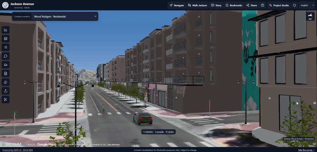
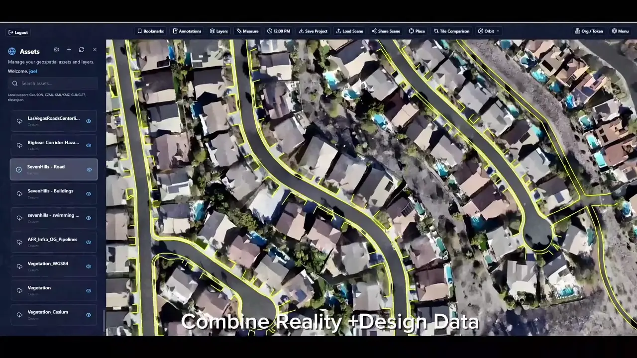
The recordings show two ways to engage with project data: exploring Jackson Avenue scenarios in Desktop, and combining spatial layers with BIM attributes in Web.
Continuing to evolve
SiEGA Web’s 1.1 update followed on July 23, 2026. The release notes trace the improvements across both products.
Choose the experience for the task
Use the browser when access and shared review are the starting point. Use Desktop when immersive exploration and simulation are central to the work. Existing CAD/BIM, imagery and other geospatial information remain part of the broader picture; a new capture is not a prerequisite for every project.
Compare the SiEGA experiences. For new reconstruction work, 3DINT Engine provides an additional early-access preparation workflow.