A grant announcement describes an opportunity. A working integration shows what came next.
Following support from the Cesium Ecosystem Grants program, AERO AI worked on restoring the connection between WebODM and Cesium ion. Our October 2024 technical article documented the reintegration and the workflow for sending processed outputs to ion.
Connect processing with delivery
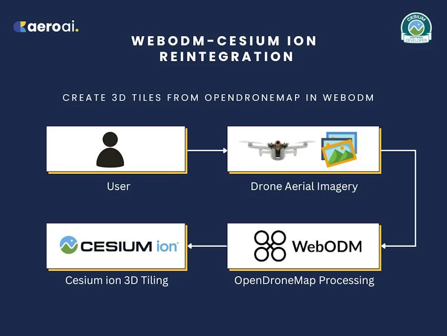
WebODM provides an open-source route into drone imagery processing. Cesium ion provides a way to prepare and host geospatial content for streaming. The integration connects those stages so that a processed result can move toward use in a larger scene.
The repair covered changes to plugin dependencies, dialogs and uploads, including packaging textured models. These details are less visible than a finished 3D view, but they matter at the point where someone tries to move their work between tools.
Why a reliable handoff matters
Processing is only part of a geospatial project. The next person may need to view the result in context, compare it with other information or explain it to a team. A repeatable handoff helps avoid a separate, improvised export process for every project.
It also gives a technical story a clear shape: begin with an input, show the preparation, identify the output and demonstrate where it is used. Readers should be able to distinguish the integration’s role from the capabilities of the applications on either side.
Follow the data, not just the upload button
The demonstration is easiest to understand as a sequence of responsibilities. First, imagery is processed into a usable output. Then that output is handed to the tiling and hosting service. Finally, the result is opened in a viewing environment where it can be explored in context.
Each stage answers a different question. Is the reconstruction suitable for its intended use? Has the complete deliverable reached the destination? Does the streamed result appear in the right place? A successful upload is one checkpoint in that sequence, not the end of the project.
For a textured model, geometry and its appearance need to travel together. For a geospatial output, placement must survive the handoff. These are good things to inspect explicitly when evaluating any processing-to-viewing workflow. Start with a known project so that missing content or unexpected placement is easier to recognize.
Keep the source and the delivered view connected
Once a result is available to a wider team, it can become detached from the decisions that created it. Record the processing project, the version of the output and the purpose of the shared view. A later update should be traceable to the source rather than treated as an unrelated asset with a similar name.
The same discipline helps when supporting a workflow. If a result looks different after delivery, compare the original output and the destination view before guessing which application is responsible. A clear record of the steps makes troubleshooting more useful than repeating the full process without knowing what changed.
A small connection with a wider role
Open-source processing, tiling services and visualization applications contribute different capabilities. Their value grows when a user can move between them without rebuilding the workflow from scratch. Reliable connections make it easier to choose tools for the job while retaining a coherent path from capture to communication.
That is the broader relevance of this project to AERO AI’s work. We are interested in what happens when data becomes something another person can inspect, discuss and use. The integration is a concrete historical example of improving that handoff; it does not replace the need to evaluate the capture or manage the destination service.
Bring the result into a wider scene
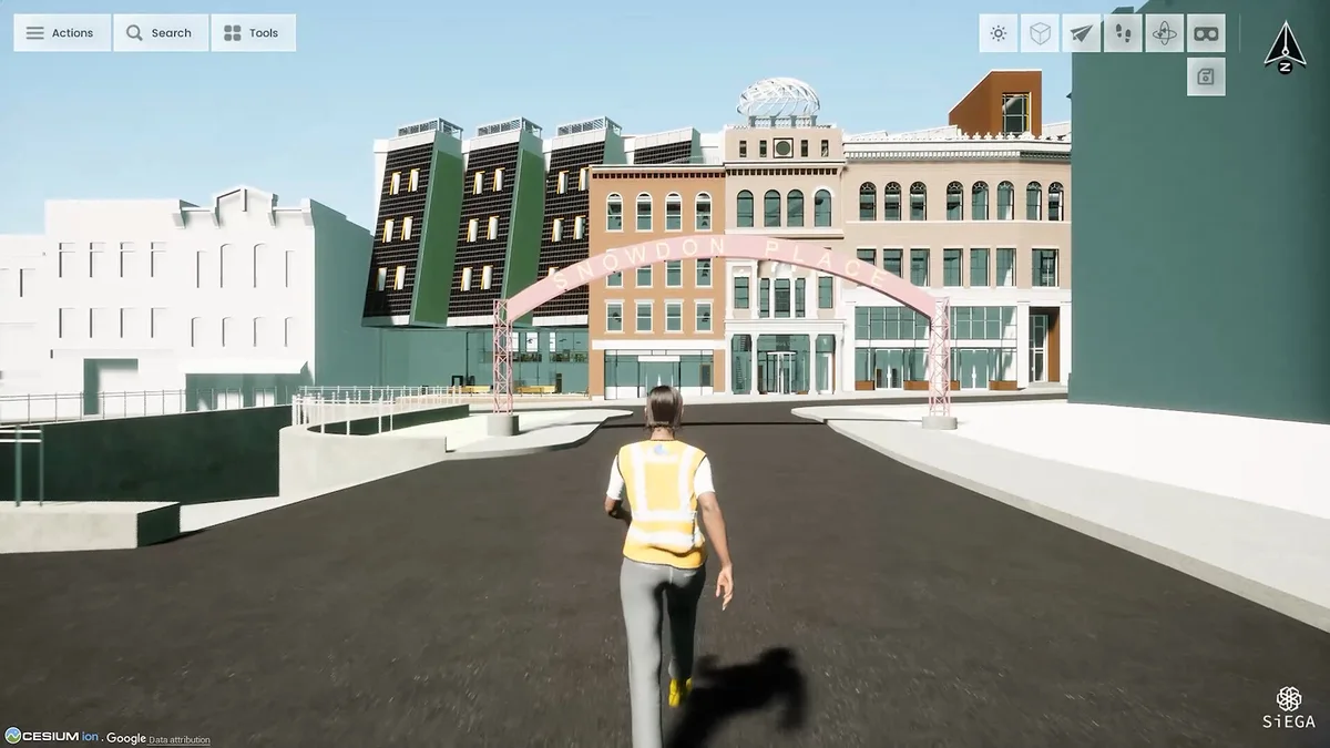
SiEGA offers a place to view deliverables alongside other spatial information. The integration story is about a connection, not a replacement for the tools that created the data.
For implementation details, read the original Cesium article. For the broader project environment, explore SiEGA.